These are the Croton and Hudson Highlands sections of Walling’s Route Guides. Hudson River . . . Maps and Descriptions by H.F. Walling, published by Taintor Brothers in New York in 1867.
The red line snaking up the east side of the river is the route of the Hudson River Railroad—what we know today as Metro-North. The Hudson River Railroad was chartered in May, 1846 and Cornelius Vanderbilt obtained control of the line in 1864—one of the first acts in the consolidation and expansion of railroads in the mid to late 1800s.


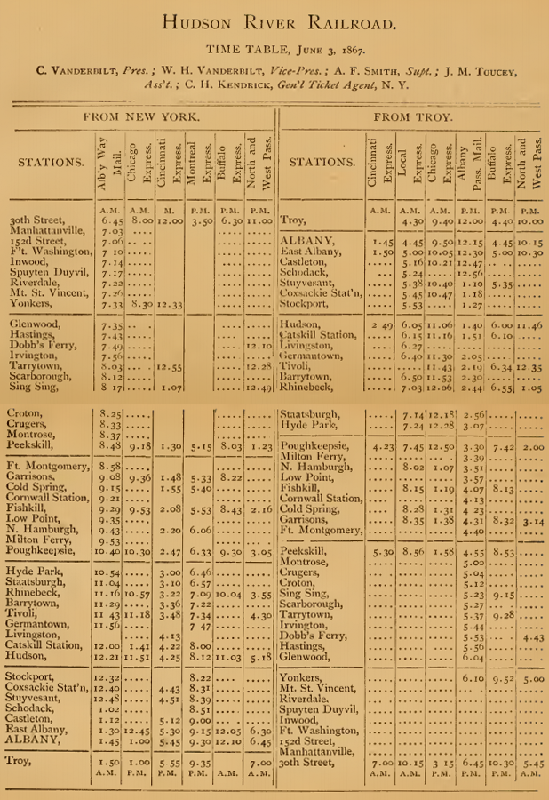
Below is the timetable from the same publication, listing Cornelius Vanderbilt as President and his son, William Henry Vanderbilt as Vice President.
The entire guide is available online.