Lenape Settlement Map, circa 1600

In 1950 Theodore J. Cornu drew this map of the lower Hudson River as the Lenape saw it, circa 1600. It appeared as a small part of page 3, in issue #1, of his extraordinary hand-drawn, hand-lettered, self-published journal, Hudson Valley Echoes.
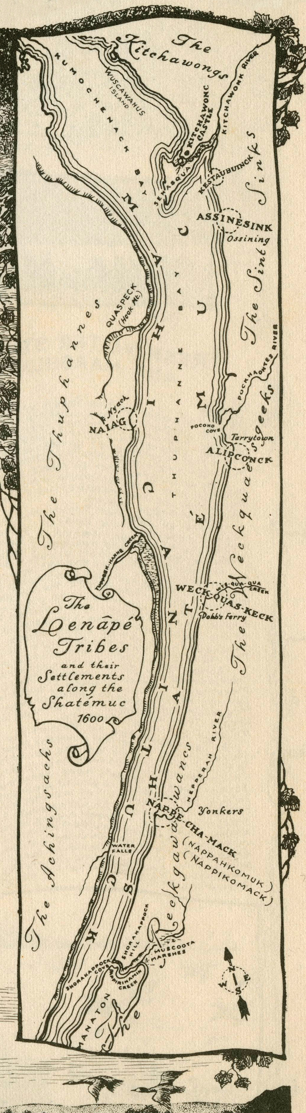
HVE-n1-p3-detail-map

Leave a Reply

Fill in your details below or click an icon to log in:

WordPress.com Logo

You are commenting using your WordPress.com account. Log Out /  Change )

Facebook photo

You are commenting using your Facebook account. Log Out /  Change )

Connecting to %s