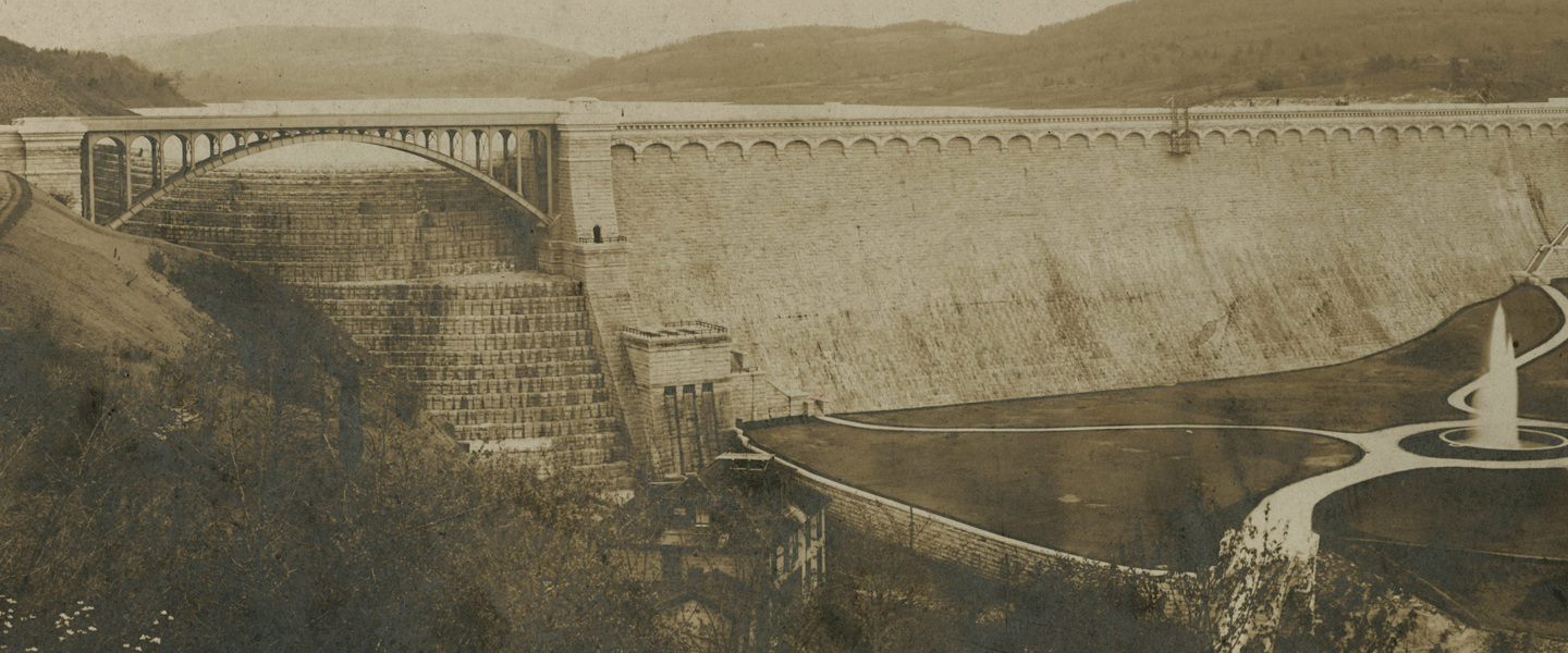
Here are two rare photographs of Quaker Bridge, both courtesy of the Westchester County Historical Society. The images show the wooden covered bridge which existed at the site of the current bridge from 1847 to 1894. The metal Pratt truss style bridge we use today—one of the oldest (possibly the oldest) bridges in daily use … Continue reading Quaker Bridge, Before 1894
Tag: Quaker Bridge
The Purdy Homestead on Quaker Ridge Road
One of the treats of this Sunday’s 18th Annual Croton Arboretum Garden Tour will be a chance to see the Purdy homestead on Quaker Ridge Road and a group of 100-year-old family photographs, lovingly preserved and made available by local restaurateur Craig Purdy. Today, the property is a magnificent 23-acre estate—no longer in the family—but … Continue reading The Purdy Homestead on Quaker Ridge Road
Quaker Bridge, circa 1914
Postcard of Quaker Bridge, circa 1914, published by Frank L. Simone, who issued postcards of many scenes of the Croton area. This card is postmarked Oscawana, July 28, 1914. Here are two other Simone cards: View from North Highland Avenue Croton Point Beach
Bird’s Eye Views of the Croton Aqueduct, 1879-1887
Here are two priceless “bird’s eye” views of the Croton Aqueduct, made eight years apart during the period when New York City was rapidly outgrowing the capacity of what we now call the Old Croton Aqueduct. One map looks north, showing the burgeoning metropolis in 1879—straining the water supply system with its unrelenting growth. The … Continue reading Bird’s Eye Views of the Croton Aqueduct, 1879-1887
The View from Quaker Bridge
Here is a post card showing the "Croton River, from Quaker Bridge, where Washington's Army Crossed." Below is a post card from the same period, showing what Quaker Bridge looked like at the time. Except for the unpaved road and the railing it looks the same as it does today, because our beloved Quaker Bridge is … Continue reading The View from Quaker Bridge
Quaker Bridge Post Card
A beautiful vintage post card, circa 1910, of Quaker Bridge—one of the oldest bridges in Westchester County. When the county repaired the bridge a few years ago they implied that it would be the last repair job before the bridge would need to be replaced. We can't let that happen.
Croton Area Topographic Map, 1891
Details of the Croton Area from Julius Bien's Atlas of the Metropolitan District and adjacent country comprising the counties of New York, Kings, Richmond, Westchester . . . Published by Julius Bien & Co. New York. 1891.
Croton River Valley, Before & After
These engravings from the June 20, 1891 issue of Scientific American show before and after views of the Croton River, when the New Croton Dam was in the planning stages. The view is looking east, with Quaker Bridge (at that time a covered bridge) in the lower right. The tributary in the foreground going to … Continue reading Croton River Valley, Before & After