
Here are two priceless “bird’s eye” views of the Croton Aqueduct, made eight years apart during the period when New York City was rapidly outgrowing the capacity of what we now call the Old Croton Aqueduct. One map looks north, showing the burgeoning metropolis in 1879—straining the water supply system with its unrelenting growth. The other looks south—to the future—showing both the path of the New Croton Aqueduct tunnel and the then-planned location (later abandoned) of “the most massive structure of its kind in the world,” the Quaker Bridge Dam.

Courtesy of the Library of Congress. Click to enlarge.
Taylor’s 1879 New York City Map
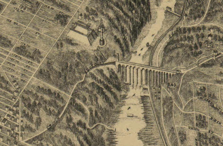
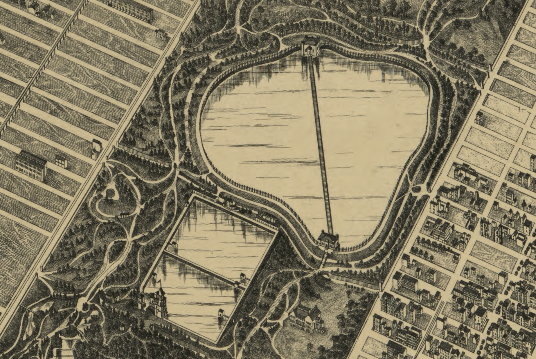
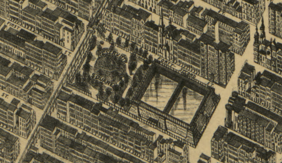
In a fascinating article about three-dimensional maps of New York City, the website Codex 99 calls this map “the first true attempt at a perspective map of the city . . . [The] four-sheet engraving, published by Galt & Hoy, attempted to label all roads and piers and depict buildings to (at least a more appropriate) scale using a vanishing perspective. It was a stunning achievement for the time.” 1 The map is so detailed that it shows all three major components of the Old Croton Aqueduct in New York City:
- High Bridge and the High Bridge Water Tower
- The Receiving Reservoir in Central Park
- The Distributing Reservoir at Fifth Avenue and 42nd Street, now the site of the New York Public Library
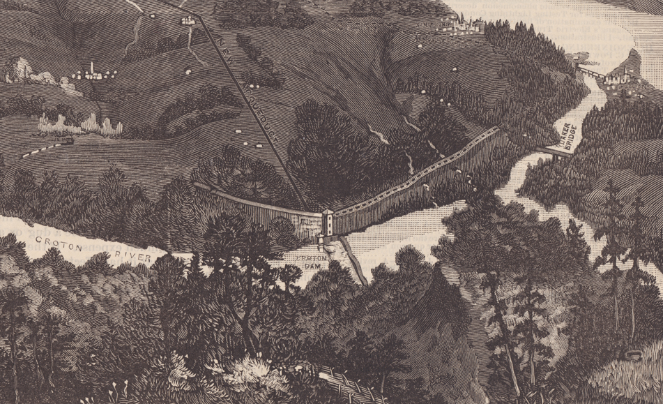
Scientific American, 1887
The cover of the June 4, 1887 issue of Scientific American featured a bird’s eye view map looking south, from the Putnam County border to New York City and beyond. The accompanying article said the map “clearly presents the course of the Croton River, the location of Muscoot, Croton, and the proposed Quaker Bridge dams, and in the dotted line shows the line of the old aqueduct and in the full black line shows the course of the new aqueduct.”
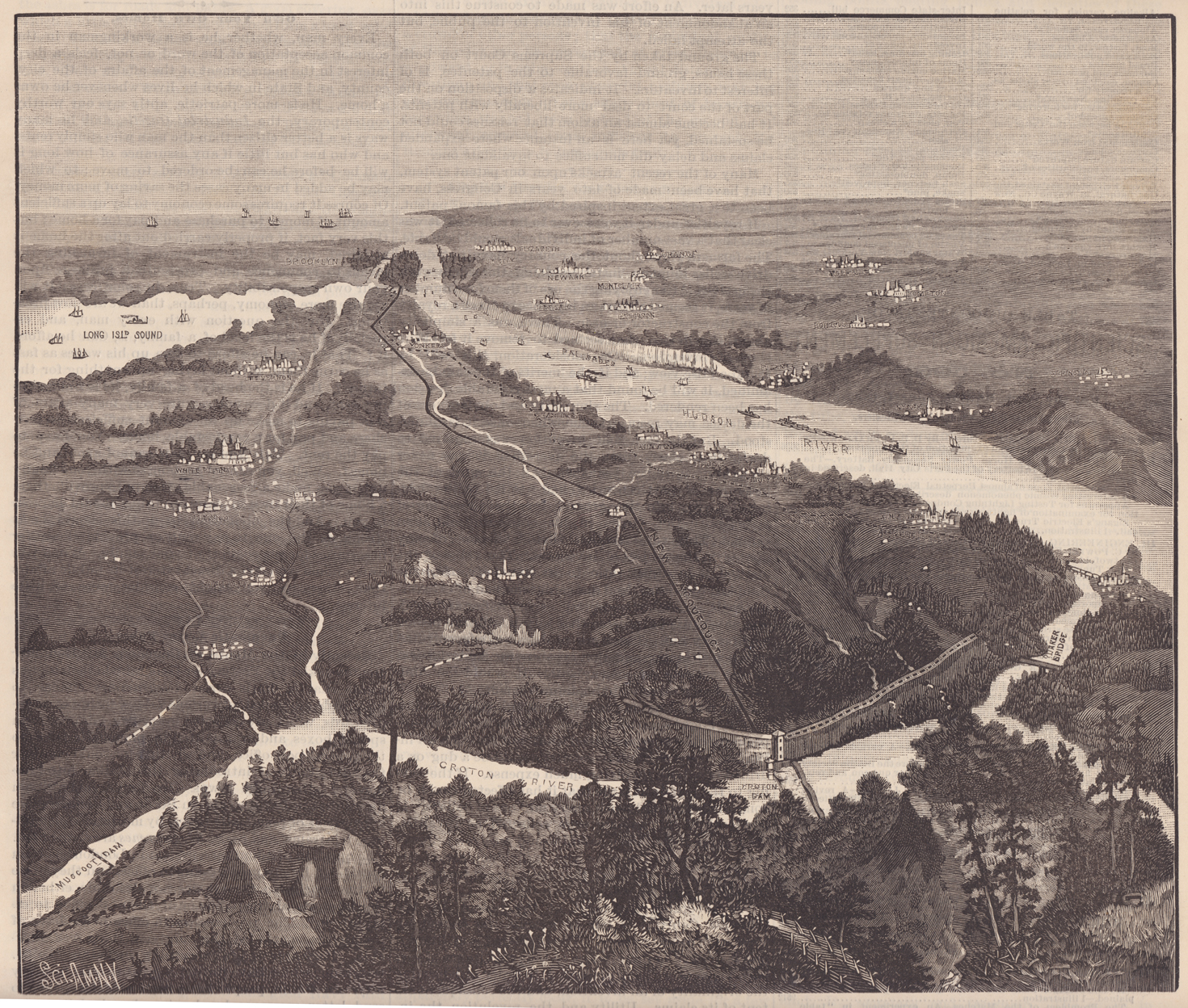
Scientific American, 1887. Click to enlarge.
When this map was published the New Croton Aqueduct tunnel was three years away from completion and the dam was still in the planning stages.2
The narrow part of the Croton, where today’s Quaker Bridge crosses the river, was one of several areas subjected to extensive planning—including test borings, cost estimates and structural plans. The site was eventually abandoned in favor of one further up-river, but in 1887 Quaker Bridge was the favored location. For Crotonites the detail showing the bridge is particularly interesting because it depicts a covered wooden bridge. The current metal Quaker Bridge—one of the oldest bridges in Westchester County—wasn’t built until 1894.
For a before-and-after bird’s eye view of the flooding of the Croton River Valley after construction of the New Croton Dam see this previous post.
