Motoring Across the Croton, 1912

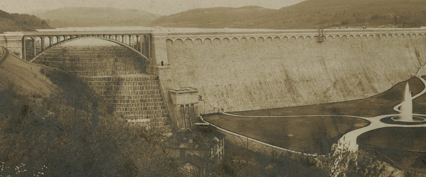
It’s a beautiful day and you’ve decided to take a jaunt in your newfangled automobile, going north along the scenic Hudson River. You can’t count on good, well-marked roads, so you’ve brought along the GPS system of the day—a copy of Photo-auto maps . . . New York to Albany which features “photographs of every … Continue reading Motoring Across the Croton, 1912

Celebrating Ossining’s Double Arch

The promenade across Ossining’s famous Double Arch has been restored and will be reopened on Saturday, July 20, with an event taking place from 4 to 6 pm. To celebrate, we've assembled a group of images relating to this famous local landmark. On May 21, 1839, the Westchester Herald said the "stupendous arch" over the … Continue reading Celebrating Ossining’s Double Arch

Croton Reservoir in Central Park, Rejected Design

In 1857 the Central Park Commission held a contest to improve the landscape design of the newly opened park. Thirty three entries were submitted, only five of which have survived today. Two of the rejected designs are currently on display at the New-York Historical Society, giving us a look at the Central Park that might … Continue reading Croton Reservoir in Central Park, Rejected Design

Croton Point, 1898

This fascinating map of "Teller's Point or Croton Point" was drawn by Edward Hagaman Hall for an article published in the March, 1898 issue of the magazine The Spirit of '76. In addition to recording the roads and buildings, Hall provided a numbered key (see below) to points of historic interest. Edward Hagaman Hall was … Continue reading Croton Point, 1898

Camping at Croton Point, 1905

"Camping at the City's Doors" was the title of an article in the June, 1905, issue of Country Life in America magazine, which described places where "one can feel as far away from civilization as upon an Adirondack lake, but a twenty minutes' row or paddle takes one across the river to catch a train, … Continue reading Camping at Croton Point, 1905

Hudson River Railroad Maps, 1867

These are the Croton and Hudson Highlands sections of Walling's Route Guides. Hudson River . . . Maps and Descriptions by H.F. Walling, published by Taintor Brothers in New York in 1867. The red line snaking up the east side of the river is the route of the Hudson River Railroad—what we know today as Metro-North. The … Continue reading Hudson River Railroad Maps, 1867

Croton Point, 1865

This detailed Civil War period map of Croton Point is but a small detail of a magnificent 4 sheet, hand-colored map of the Hudson River, produced by the United States Coast Survey from 1861 to 1865. Kaaterskill Books, which offers fine, rare, and unusual books in a variety of fields, is offering this map for … Continue reading Croton Point, 1865

Croton Area in 1886

Detail of the Croton area from Colton's Map of the County of Westchester. Drawn, Engraved and Published by G.W. & C.B. Colton & Co. 182 William St. New York. 1886. The entire map is available online at David Rumsey Map Collection.

Croton Area in 1848

Detail of the Croton area from the Travellers' Guide of the Hudson River. Published by H.B. Kirkham, for the Proprietor, and for sale on all the Steamboats, and at the principal Hotels in the United States, 1848. The entire map is available online at David Rumsey Map Collection.

Croton Area in 1830

Details of the Croton area from An Improved Map of the Hudson River, with the Post Roads between N. York & Albany. Published by S. Mahon & Co. Drawn & Engraved Expressly for the Tourist. 1830. The entire map is available online at David Rumsey Map Collection.